Tuesday, January 31, 2012

simmsciara

Dear Editor,
http://sintraingenieros.es/mmwfgtyint.php?opoxpage=23

Tue, 31 Jan 2012 22:39:36
__________________
"Caleb did not answer, but walked along by the side of the wheelbarrow." (c) Chelsey xaxaxai3a

Thursday, June 26, 2008

Day 19: Monday, June 23

(Susan) Today was our last day on the trail. We hiked from the Mt Nebo area back to Albright (near Kingwood)--probably not more than 8 miles or so. Since we made the decision not to complete the yo-yo, we needed to figure out how to get back to our car in Pearisburg. We formulated a plan while hiking and it all came together without a hitch: When we arrived back in Albright, we went to Teter's Campground and took a shower. The owner graciously allowed us to use her internet to check local bus schedules--then drove us the few miles into Kingwood where we ate lunch and used the internet at the library to arrange for a one way rental car. In Kingwood we took the Buckwheat Express (a small regional bus service) to Morgantown where the driver let us off right in front of Enterprise rental. The economy car we ordered hadn't been returned and the Enterprise folks talked us into taking a panel van for the same price--and throwing in a half a tank of gas for free. They also didn't tack on any fee for the one way rental as long as we returned the vehicle to another location in WV. So in late afternoon we headed down to Pearisburg with a large empty van (save a couple of backpacks)--and are spending the night at the Rendevous Hotel in Pearisburg, VA where we had left our car. The folks that own the Rendevous are big supporters of AT hikers--and they stay pretty booked up with the hiking crowd this time of year. We got lucky and got the last room available. Tomorrow we will return the van to an Enterprise rental place in Princeton, WV, then head home to SC. Another thru-hike+ completed!

On an AT related note: We also reminisced with Rendevous owner Brenda (?) about Tillie Woods, who operated the Wood's Hole Hostel south of Pearisburg. Tillie passed away earlier this year at the age of 89. Her hostel was the coolest place! A restored log cabin with several outbuildings, an outdoor shower, privy, bunkhouse/barn where the hikers slept in a loft. If you were one of the first 8 folks to arrive on a given day, you could eat breakfast in the main cabin the next morning. On our 2002 AT thru-hike, D and I were #7 and #8 to arrive so we got to spend time talking to Tillie about the little cabin she and her late husband had bought in the 40's when he was a grad student studying elk in the area. Tillie's granddaughter owns the old cabin now and is currently having it enlarged and was getting rid of some of Tillie's older furnishings. Brenda (the owner of the Rendevous) got a number of Tillie's hand-made rugs that were being thrown out, and gave me one as a souvenir. I'll treasure it as a memento of our hike and stay at Wood's Hole.

Wednesday, June 25, 2008

Day 18: Sunday, June 22

(Susan) Toward dusk last night the thunder started rumbling and D insisted on putting up the tarp. I really didn't think it was going to rain, but shortly after the tarp went up the thunder got louder and more consistent, then lightening, then heavy rain. We were perfectly dry under the tarp. After the rain subsided a bit,the traffic up and down the road started up again and continued throughout the night. Based on what we have seen where we are camped this evening, it is simply what folks do around here for entertainment. They ride ATVs, cars, trucks, golf carts, and dirt bikes up and down the road for pleasure -- and last night I thought is was because they were on the lookout for trespassing hikers! But, back to the trail. We headed out shortly before 7 am. The trek to the northern terminus of the Allegheny Trail was only about 12 1/2 miles--mostly taking us by large open farms. When we started out there was heavy haze that burned off by 10 and it seemed to be the makings of another hot day. A few 10ths of a mile before the trail finish on the Mason Dixon line on the WV/PA border, a woman who was working in her front yard offered us some water. I gratefully had her fill my 2 water bottles. (Not using a platy this trip). She told us to feel free to use the hose out back on our return trip. She also told us the had driven some overheated hikers home in the past--and Dwight commented she was a "trail angel in the making". 
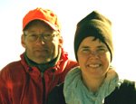
The end of the trail (or what is generally considered the beginning) was simply a final yellow blaze on a signpost marking the dividing line of Preston Co, WV and Fayette Co, PA. Seemed odd that a more prominent sign was not posted. There was, however, a nearby kiosk and parking area next to a Columbia Gas substation. We could not locate the brass plaque marking the Mason Dixon line that was mentioned in the hiking guide. We took a couple of "finish photos", and had lunch under the shade of a maple tree. We also hung our wet tarp to dry and laid out our dew damp sleeping bags in the sun. The afternoon was cooler than expected since intermittent cloud cover moved in. We retraced our steps to milepost 13.5 near the Mt Nebo Church (which we were told now has a total of 4 parishioners). A local farmer there, Glenn Miller, allows folks to camp in his yard. We are getting quite the stares from the folks driving up and down the road. ATTENTION: HIKERS ON DISPLAY!!!

We had originally planned to yo-yo the trail, but have decided one trip down the trail is enough. There's a lot more road walk than I expected--and perhaps we didn't pick the best time of year to hike this trail. Fall would be cooler, likely bug free and NO STINGING NETTLES! But then there wouldn't be the mountain laurel in full bloom and the fragrant cinnamon fern would be gone for the season. And fall gear is heavier than summer gear. Pluses and minuses to everything.

Day 17: Saturday June 21

(Susan) Yet another day of road walk except the first part of the day which was technically on a PCR (whatever that is!). We're not sure if this stands for "Pretty Country Road" or "Pretty Crummy Road" (since the road surface, width and condition vary widely)--but it's some numbering system (i.e. we went from PCR 7/33 to PCR 3/12). The prc we camped on last night started out as a narrow gravel road next to a farm field--but then turned into an active stream bed just before heading into the woods where we camped last night.

We got to the outskirts of Albright and had no luck trying to get a hitch into Kingwood to resupply--so we walked the 3+ miles into town on the side of fairly busy secondary highways. It was nerve wracking at times. We had lunch at the pizza hut, resupplied at Food Town, and paid the parent of a group of cheerleaders (fund raising by washing cars) $15 to drive us back to Albright. They were raising money for new pompoms - seriously. It was an expensive taxi ride, but we considered it well worth it given how hot it was and how harrowing the road walk was into town. From just beyond Muddy Creek, the trail had been rerouted because a timber company apparently retracted right-of-way through their land. We were told this was because they were afraid hikers would mess with their equipment. (I know that's always high on my list!) So instead of skirting the mountain on rail grade trail near the creek, the reroute took us up over the mountain on mostly gravel roads. It was hot and uneventful. It was not until late in the day that we could match our trail guide to our current location and we are guessing that the reroute may have cut out 5 miles. On the yo-yo we may try to hike the old route since an Albright campground owner (Teter's Campground) told us hikers were still going through there with no repercussion. We are camped above a creek in the only area we could find that is not Posted. However, I'm sure we on privately owned land so we're trying to be as stealth as possible even though we are probably only 100 feet from the road. There are a fair number of vehicles going up and down the road and every time one slows down I get paranoid we're going to get spotted and kicked out. Can't wait for dark!

Day 16: Friday June 20

(Susan) Another day of road walking until the last mile which although is off road is on Posted property. We are camped here anyway (stopped early-6:50) because the trail will leave the woods again soon. After a few cooler days it warmed up again today. No rain except a very short 3 minute shower--just long enough to pull out the rain gear, then put it all away again. We did a quick resupply in Rowlesburg in late morning--about a 3/4 mile walk into town and out. Hoped to find a restaurant open, but there are no longer any in town. The small grocery had a deli though and we ordered a disappointing pizza. The town looks like it's getting spiffed up--we ate lunch in a small park next to the grocery that appears recently completed. Most of main street is boarded up stores except a bank and "Curiosity Shop". In retrospect, I had enough food to get Dwight to the next resupply--which will be tomorrow in Kingwood. But I enjoyed seeing the town.

Day 15: Thursday, June 19

(Susan) A long day of walking--from about 7:30 am to 9pm -covering about 31 miles. It was all road walk except perhaps 2 miles--time mile from where we were camped to the first road, then a short bit off Close Mtn Rd. At the end of the day the feet were pretty sore. Some highlights: - Around 11am the road went by an unsigned campground on Horseshoe Creek near the hamlet of Leadmine. We didn't think it was the campground mentioned in the guidebook (and it wasn't) but they had a coke machine with a big WVU emblem on it and cokes were only 50 cents. The guy running it--probably in his late 50's--took over for an elderly aunt who ran it for years. He took me into a small chapel where a lot of old family photos were displayed. He also showed me some of the original campground cottages--very small board and batten structures made of chestnut. He recently retired from Consolidated (mining). We spent about an hour chatting with him, his wife and a buddy also recently retired from Consol. We were not far enough into the day to stop for the night but they would have given us a tenting spot for $5. Very nice folks. - Also in Leadmine a couple of children (under the supervision of their mother and grandmother) were selling lemonade and brownies on the side of the rd. Saving money for a trip to Myrtle Beach. Can't imagine they would get many customers on this quiet country road so we tipped big. - We stopped for a break on the bridge to the old Cheat River Campground--now a private getaway for a Morgantown lawyer. The caretaker, Richard, saw us and stopped to chat. (We think he was really making sure we weren't planning to stay for the night.) What a character! He told us the campground ended up in the hands of the lawyer because the owner nearly killed a fellow with a baseball bat after the 2 got into a fight. He kept us entertained for quite some time. He told us many cycling races came right down the road there--and he didn't like it because he was a volunteer EMT and always "had to scrape a couple of them off the front of 18 wheelers". - Given that we road walked with NO TRESPASSING signs posted every few feet, we walked until 9 to get to a shelter 1/2 mile off the trail. We actually missed a turn en route due to oncoming darkness so it took us much longer to get there than expected--and I was taking a painstaking amount of time getting there since the jeep road to the shelter was a muddy mess and I was determined to keep my feet dry! As luck would have it, we made it to another shelter just before it started pouring. I was too tired for dinner. Ate a cheese stick and packed it in for the night.

Day 14 : Wednesday, June 18

(Susan) We took our time leaving Davis today. Breakfast at the Bright Morning Inn was eggs cooked to order, bacon, excellent biscuits, fruit and coffee. Delicious. After breakfast, Susan Moore, the proprietor of the inn graciously let us use her computer, phone and leave our things in her guest lounge area as we ran around doing errands. We resupplied our food and D bought new shoes at a local outfitter. He and been hiking with a 5” tear along the heal cup of one shoe for several days. I couldn't talk him into duck taping the whole mess directly onto his foot. Before we left Davis we had some delicious burritos at Hellbenders—of course I had to order the one called the “Lost Hiker”. (Our hike has made it's natural transition to becoming all about food.) We finally headed out of town around 1:30. The first part of the hike was a road walk to the outskirts of Thomas—just a few miles down the road from Davis. The “trail” went right by a WV artisan gallery called Mountain Made located in a chicly restored building. Very high end art and craft. I took some pics of dulcimers I thought our friend Charlotte Williams (also a dulcimer maker) might find interesting. The road walk continued to a fire service road that connected to a beautiful rim trail that we are camped next to now. At the intersection of the FS road and the trail was an established campsite with a picnic table, fire ring and a big blue overstuffed lounge chair! In the fire ring next to the chair was a pizza box with the label “Big Daddy”. I wasn't sure whether to laugh or cry! Dwight actually tried the chair and said it was very comfortable (and apparently waterproof since it wasn't wet). The thunder has been rumbling since before we set up camp—but no rain other than a few sprinkles. Sure hope we have another rain free day tomorrow. Temps have been in the low 60's the last 2 days—perfect for hiking and almost no bugs!